CCM 
|
CCM 
|

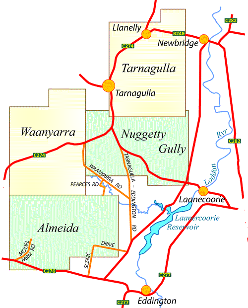
The CCM Waanyarra Map Set covers, with four maps, the adjoing group of forests: Llanally Sf, Waanyarra NCR, Waanyarra SF, Tarnagulla SF and Waanyarra─Dunolly SF to the broad North-East of Dunolly in Central Victoria Australia. The individual map pages can be accessed:-
There are numerous mine shafts and other hazardous structures within the area covered by the maps. Travellers should take care.
Each map can be downloaded as a PDF file. The intended print size for each map is A3. This A4 PDF – Waanyarra Map Set – containing similar material to the map to the right can be downloaded.
Information on the use of other files supplied by CCM can be found via the Appendix panel of the header menu.
The principal resource is simply boot leather; if a road or track within the designated area (and many of those outside the designated area) is indicated on a map then CCM has walked it. Other resources that have been used in the construction of the maps are:
| Single-sided PDF map for printing at A4 (< 160 kB) | Download |